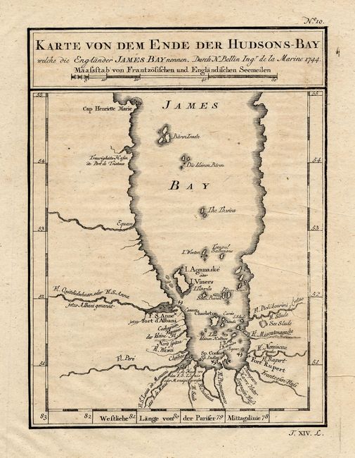
Title:
“Karte von dem Ende der Hudsons-Bay welche die EnglanderJames Bay nennen”
Map Maker:
Jacques Nicolas Bellin
A German edition of Bellin's map of James Bay, ext... (full text available to subscribers)
| Item Detail |
| |
| |
MapMaker: |
Jacques Nicolas Bellin
|
|
| |
| |
Subject: |
Canada |
|
| |
Period/Size: |
1744 / 7.5" x 5.5" (19.1 x 14.0 cm)
|
|
| |
Color: |
Black & White
|
|
| |
Condition: |
(B) On a sheet of fine hand laid paper with full margins. A hint of toning or foxing and tiny printer's creases, else very good. (condition help) |
|
| |
Source: |
Allegmeine Historie der Reisen zu Wasser und zu Lande |
|
| |
References: |
Kershaw #426. |
|
| |
|
|
| Sales Information |
| |
| |
Price: |
|
|
| |
| |
Offered by: |
Old World Auctions |
|
| |
Catalog: |
Auction No. 109 - Antique Maps, Charts, Atlases & Globes (385) |
|
| |
Lot/Item #: |
130 |
|
| |
| |
Date: |
12/2004
|
|
| |
| |
|
Antique Maps - Valuation and Pricing, Descriptions, Resources |
|
Home |
Information |
Search |
Register |
Contact Us |
Site Map
Americana Exchange, Inc. © 1999 - 2024 Americana Exchange, Inc.. All rights reserved.
OldMaps.com, the OldMaps.com logo and
AMPR are service marks or registered service marks of Americana Exchange, Inc..
|