Title:
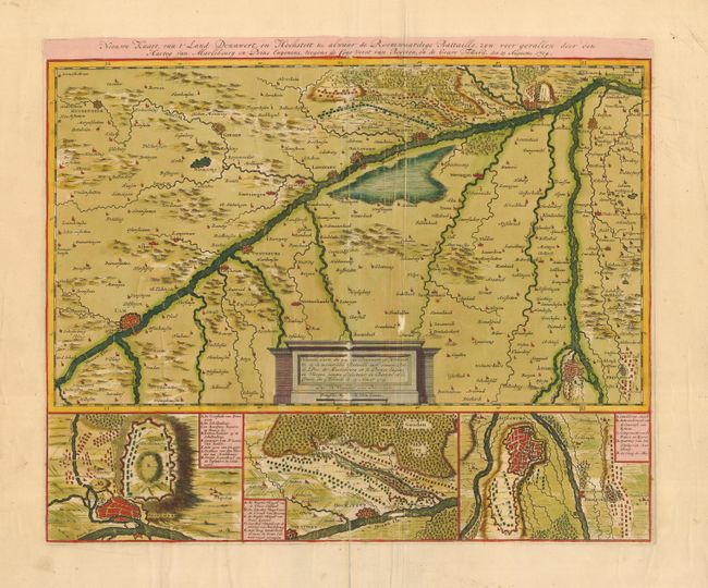
“Nieuwe Kaart van t' Land Donawert, en Hochstett, &c. alwaar de Roemwaardige Battaille, zyn voor gevallen door den Hartog van Marlebourg en Prins Eugenius, teegens de Ceur Vorst van Beyeren, en de Grave Tallard, den 13 Augustus 1704”
Map Maker:
Nicolas Visscher
Detailed map showing the region between Ulm, Donau... (full text available to subscribers)
| Item Detail |
| |
| |
MapMaker: |
Nicolas Visscher
|
|
| |
| |
Subject: |
Germany |
|
| |
Period/Size: |
1710 / 15.5" x 18.8" (39.4 x 47.8 cm)
|
|
| |
Color: |
Colored
|
|
| |
Condition: |
(C) Original color. Backed with heavy (modern) linen. Some creases with small area of paper loss (without loss of engraving) and some abrasions in cartouche. An attractive map that would benefit from conservation. (condition help) |
|
| |
Source: |
|
|
| |
References: |
|
|
| |
|
|
| Sales Information |
| |
| |
Price: |
|
|
| |
| |
Offered by: |
Old World Auctions |
|
| |
Catalog: |
Auction No. 109 - Antique Maps, Charts, Atlases & Globes (385) |
|
| |
Lot/Item #: |
477 |
|
| |
| |
Date: |
12/2004
|
|
| |
| |
|
Antique Maps - Valuation and Pricing, Descriptions, Resources |
|
Home |
Information |
Search |
Register |
Contact Us |
Site Map
Americana Exchange, Inc. © 1999 - 2024 Americana Exchange, Inc.. All rights reserved.
OldMaps.com, the OldMaps.com logo and
AMPR are service marks or registered service marks of Americana Exchange, Inc..
|