Rister or Sign In to see pricing information


Title:

Submarine Cables of the World with the Principal Connections and lines Also Coaling, Docking and Repair Stations

Map Maker:

U.S. Navy

Submarine Cables of the World with the Principal Connections and lines Also Coaling, Docking and Repair Stations

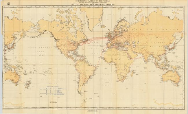
A large and fascinating map (drawn on Mercator's p... (full text available to subscribers)
Item Detail
 
  MapMaker:  

U.S. Navy


  Subject:  World  
  Period/Size:  1896 / 27.0" x 47.7"  (68.6 x 121.2 cm)  
  Color:  Colored  
  Condition:  (B) Map is fine, except for some fold and intersection splits, some of which are repaired on verso with archival tape. (condition help)  
  Source:  National Geographic Magazine  
  References:   
 
 
Sales Information
 
  Price: 

Please register your email to view records, or sign in with email address to see records


  Offered by:  Old World Auctions  
  Catalog:  Auction No. 109 - Antique Maps, Charts, Atlases & Globes (385)  
  Lot/Item #:  038  
 
  Date:  12/2004  


Antique Maps - Valuation and Pricing, Descriptions, Resources


Home | Information | Search | Register | Contact Us | Site Map

Americana Exchange, Inc. © 1999 - 2024 Americana Exchange, Inc.. All rights reserved. OldMaps.com, the OldMaps.com logo and
AMPR are service marks or registered service marks of Americana Exchange, Inc..