Title:
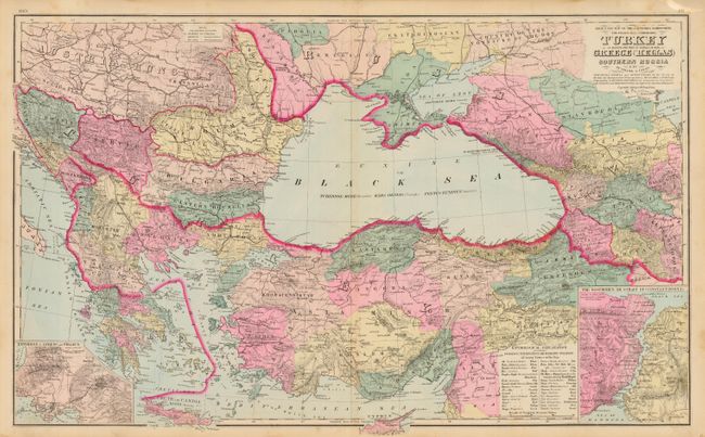
“Gray's New Map of the Countries Surrounding The Black Sea - Comprising Turkey in Europe, and Part of Turkey in Asia, Greece (Hellas) Southern Russia etc.”
Map Maker:
O.W. Gray & Son
A lovely double-page map that details the countrie... (full text available to subscribers)
| Item Detail |
| |
| |
MapMaker: |
O.W. Gray & Son
|
|
| |
| |
Subject: |
Black Sea and Balkans |
|
| |
Period/Size: |
1881 / 16.3" x 26.8" (41.4 x 68.1 cm)
|
|
| |
Color: |
Colored
|
|
| |
Condition: |
(A) Fine, dark impression with bright original hand coloring. Hint of toning along centerfold. (condition help) |
|
| |
Source: |
The National Atlas |
|
| |
References: |
|
|
| |
|
|
| Sales Information |
| |
| |
Price: |
|
|
| |
| |
Offered by: |
Old World Auctions |
|
| |
Catalog: |
Auction No. 109 - Antique Maps, Charts, Atlases & Globes (385) |
|
| |
Lot/Item #: |
520 |
|
| |
| |
Date: |
12/2004
|
|
| |
| |
|
Antique Maps - Valuation and Pricing, Descriptions, Resources |
|
Home |
Information |
Search |
Register |
Contact Us |
Site Map
Americana Exchange, Inc. © 1999 - 2024 Americana Exchange, Inc.. All rights reserved.
OldMaps.com, the OldMaps.com logo and
AMPR are service marks or registered service marks of Americana Exchange, Inc..
|