Title:
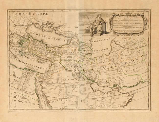
“Persarum Imperium In Viginti Satrapias Vectigales distibutum, ut Eas Ordinaverat Darius Histaspis silius tertius Persarum Rex, Cujus Monarchia, ab India usque ad Aethiopiam, In Centum et viginti Septem divisa Provincias…”
Map Maker:
Pierre Moullart-Sanson
This is a very uncommon historical map of the regi... (full text available to subscribers)
| Item Detail |
| |
| |
MapMaker: |
Pierre Moullart-Sanson
|
|
| |
| |
Subject: |
Near and Middle East |
|
| |
Period/Size: |
1721 / 16.2" x 22.8" (41.2 x 58.0 cm)
|
|
| |
Color: |
Colored
|
|
| |
Condition: |
(B) Original outline color. Light scattered foxing. (condition help) |
|
| |
Source: |
|
|
| |
References: |
|
|
| |
|
|
| Sales Information |
| |
| |
Price: |
|
|
| |
| |
Offered by: |
Old World Auctions |
|
| |
Catalog: |
Auction No. 110 - Antique Maps, Charts, Atlases & Globes (386) |
|
| |
Lot/Item #: |
576 |
|
| |
| |
Date: |
03/2005
|
|
| |
| |
|
Antique Maps - Valuation and Pricing, Descriptions, Resources |
|
Home |
Information |
Search |
Register |
Contact Us |
Site Map
Americana Exchange, Inc. © 1999 - 2024 Americana Exchange, Inc.. All rights reserved.
OldMaps.com, the OldMaps.com logo and
AMPR are service marks or registered service marks of Americana Exchange, Inc..
|