Title:
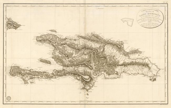
“Carte Particuliere de l' Ile de Saint Domingue Dressee d' apre's divers Plans manuscrits communiques par le Cen. Sorrel Ingenieur des Colonies…”
Map Maker:
Jacques de Chastenet-Puisegur
This large chart of present-day Haiti and the Domi... (full text available to subscribers)
| Item Detail |
| |
| |
MapMaker: |
Jacques de Chastenet-Puisegur
|
|
| |
| |
Subject: |
Caribbean, Hispaniola |
|
| |
Period/Size: |
1802 / 21.6" x 36.0" (54.9 x 91.5 cm)
|
|
| |
Color: |
Black & White
|
|
| |
Condition: |
(B) Repair of some small worm tracks along centerfold. Faint water stain along lower centerfold. (condition help) |
|
| |
Source: |
Le Pilote de l'Isle de Saint-Dominigue |
|
| |
References: |
|
|
| |
|
|
| Sales Information |
| |
| |
Price: |
|
|
| |
| |
Offered by: |
Old World Auctions |
|
| |
Catalog: |
Auction No. 110 - Antique Maps, Charts, Atlases & Globes (386) |
|
| |
Lot/Item #: |
279 |
|
| |
| |
Date: |
03/2005
|
|
| |
| |
|
Antique Maps - Valuation and Pricing, Descriptions, Resources |
|
Home |
Information |
Search |
Register |
Contact Us |
Site Map
Americana Exchange, Inc. © 1999 - 2024 Americana Exchange, Inc.. All rights reserved.
OldMaps.com, the OldMaps.com logo and
AMPR are service marks or registered service marks of Americana Exchange, Inc..
|