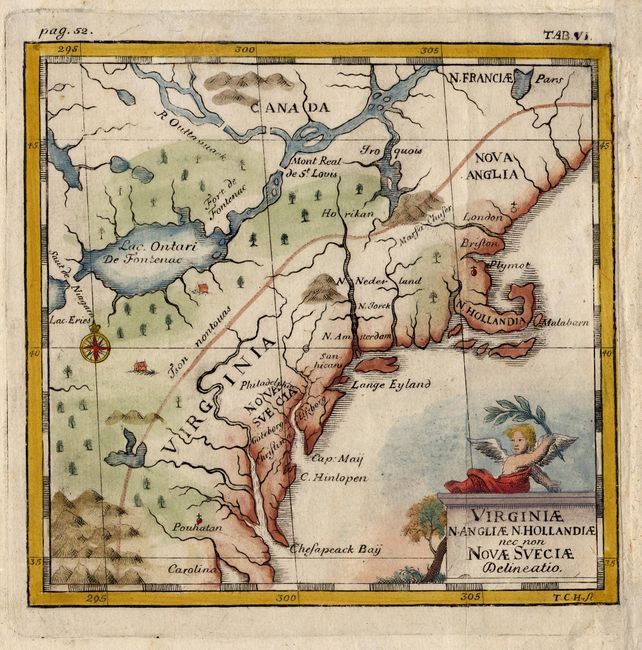
Title:
“Virginiae N. Angliae N. Hollandiae nec non Novae Sveciae Delineatio”
Map Maker:
Thomas Campanius Holm
This rare little map shows the east coast from Mai... (full text available to subscribers)
| Item Detail |
| |
| |
MapMaker: |
Thomas Campanius Holm
|
|
| |
| |
Subject: |
Colonial United States |
|
| |
Period/Size: |
1702 / 5.0" x 5.2" (12.7 x 13.2 cm)
|
|
| |
Color: |
Colored
|
|
| |
Condition: |
(A) Remargined at right. (condition help) |
|
| |
Source: |
Kort Beskrifning om Provincien nya Swerige |
|
| |
References: |
McCorkle #702-4. |
|
| |
|
|
| Sales Information |
| |
| |
Price: |
|
|
| |
| |
Offered by: |
Old World Auctions |
|
| |
Catalog: |
Auction No. 110 - Antique Maps, Charts, Atlases & Globes (386) |
|
| |
Lot/Item #: |
119 |
|
| |
| |
Date: |
03/2005
|
|
| |
| |
|
Antique Maps - Valuation and Pricing, Descriptions, Resources |
|
Home |
Information |
Search |
Register |
Contact Us |
Site Map
Americana Exchange, Inc. © 1999 - 2024 Americana Exchange, Inc.. All rights reserved.
OldMaps.com, the OldMaps.com logo and
AMPR are service marks or registered service marks of Americana Exchange, Inc..
|