Title:
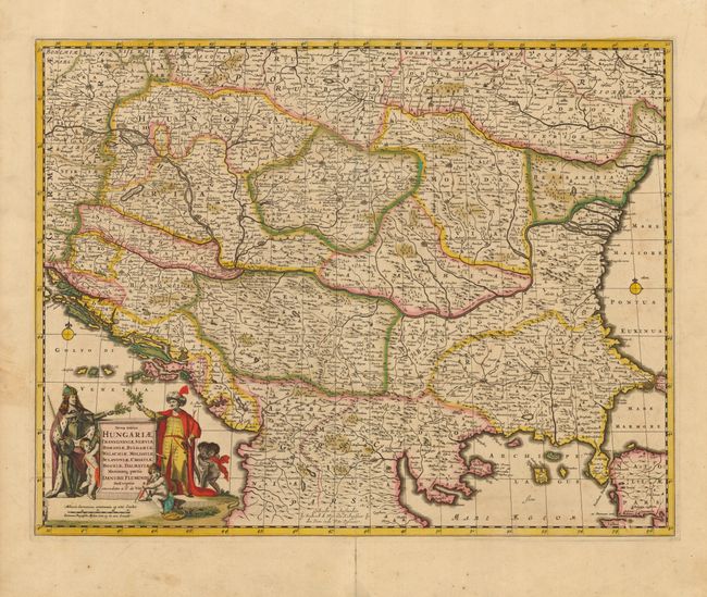
“Nova totius Hungariae, Transilvaniae, Serviae, Romaniae, Bulgariae, Walachiae, Moldaviae, Sclavoniae, Croatiae, Bosniae, Dalmatiae Maximaeqss partis Danubii Fluminis Descriptio”
Map Maker:
Frederick de Wit
This is a beautiful map of the Balkans filled with... (full text available to subscribers)
| Item Detail |
| |
| |
MapMaker: |
Frederick de Wit
|
|
| |
| |
Subject: |
Balkans |
|
| |
Period/Size: |
1668 / 17.4" x 22.5" (44.2 x 57.2 cm)
|
|
| |
Color: |
Colored
|
|
| |
Condition: |
(B) Lovely original color with some oxidation resulting in minor cracking along some green lines, partially stabilized with Japanese tissue on verso. Centerfold split extending 2" into map without loss. One small abrasion in lower right corner. (condition help) |
|
| |
Source: |
|
|
| |
References: |
|
|
| |
|
|
| Sales Information |
| |
| |
Price: |
|
|
| |
| |
Offered by: |
Old World Auctions |
|
| |
Catalog: |
Auction No. 110 - Antique Maps, Charts, Atlases & Globes (386) |
|
| |
Lot/Item #: |
528 |
|
| |
| |
Date: |
03/2005
|
|
| |
| |
|
Antique Maps - Valuation and Pricing, Descriptions, Resources |
|
Home |
Information |
Search |
Register |
Contact Us |
Site Map
Americana Exchange, Inc. © 1999 - 2024 Americana Exchange, Inc.. All rights reserved.
OldMaps.com, the OldMaps.com logo and
AMPR are service marks or registered service marks of Americana Exchange, Inc..
|