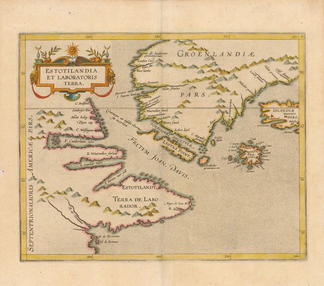
Title:
“Estotilandia et Laboratoris Terra”
Map Maker:
Cornelis Wytfliet
This fascinating map is from the first printed atl... (full text available to subscribers)
| Item Detail |
| |
| |
MapMaker: |
Cornelis Wytfliet
|
|
| |
| |
Subject: |
Canada and Arctic |
|
| |
Period/Size: |
1607 / 9.0" x 11.5" (22.9 x 29.3 cm)
|
|
| |
Color: |
Colored
|
|
| |
Condition: |
(A) Three very tiny wormholes professionally infilled. (condition help) |
|
| |
Source: |
Histoire Universelle des Indes Occidentales et Orientales |
|
| |
References: |
Burden #101; Kershaw #40. |
|
| |
|
|
| Sales Information |
| |
| |
Price: |
|
|
| |
| |
Offered by: |
Old World Auctions |
|
| |
Catalog: |
Auction No. 110 - Antique Maps, Charts, Atlases & Globes (386) |
|
| |
Lot/Item #: |
090 |
|
| |
| |
Date: |
03/2005
|
|
| |
| |
|
Antique Maps - Valuation and Pricing, Descriptions, Resources |
|
Home |
Information |
Search |
Register |
Contact Us |
Site Map
Americana Exchange, Inc. © 1999 - 2024 Americana Exchange, Inc.. All rights reserved.
OldMaps.com, the OldMaps.com logo and
AMPR are service marks or registered service marks of Americana Exchange, Inc..
|