Title:
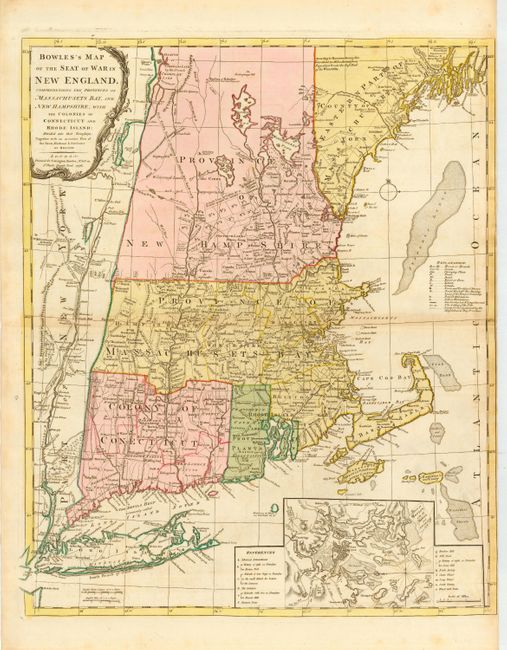
“Bowles's Map of the Seat of War in New England, Comprehending the Provinces of Massachusets Bay, and New Hampshire, with the Colonies or Connecticut and Rhode Island…”
Map Maker:
Carington Bowles
This great Revolutionary War period map is ... (full text available to subscribers)
| Item Detail |
| |
| |
MapMaker: |
Carington Bowles
|
|
| |
| |
Subject: |
Colonial New England |
|
| |
Period/Size: |
1776 / 25.0" x 21.0" (63.5 x 53.4 cm)
|
|
| |
Color: |
Colored
|
|
| |
Condition: |
(A) Overall very good with slight toning and one tiny wormhole along centerfold. Right margin trimmed nearly to neatline, apparently as issued. (condition help) |
|
| |
Source: |
|
|
| |
References: |
Fite & Freeman #60; McCorkle #776-8; Sellers & Van Ee #811; Stevens & Tree #32-c. |
|
| |
|
|
| Sales Information |
| |
| |
Price: |
|
|
| |
| |
Offered by: |
Old World Auctions |
|
| |
Catalog: |
Auction No. 110 - Antique Maps, Charts, Atlases & Globes (386) |
|
| |
Lot/Item #: |
128 |
|
| |
| |
Date: |
03/2005
|
|
| |
| |
|
Antique Maps - Valuation and Pricing, Descriptions, Resources |
|
Home |
Information |
Search |
Register |
Contact Us |
Site Map
Americana Exchange, Inc. © 1999 - 2024 Americana Exchange, Inc.. All rights reserved.
OldMaps.com, the OldMaps.com logo and
AMPR are service marks or registered service marks of Americana Exchange, Inc..
|