| Item Detail |
| |
| |
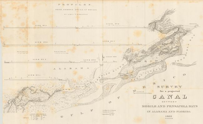
MapMaker: |
U.S. Government
|
|
| |
| |
Subject: |
Florida and Alabama |
|
| |
Period/Size: |
1833 / 20.0" x 33.0" (50.8 x 83.9 cm)
|
|
| |
Color: |
Black & White
|
|
| |
Condition: |
(B) Issued folding, now pressed and backed with archival tissue. Occasional scattered foxing, paper sound and quite clean otherwise. (condition help) |
|
| |
Source: |
HR doc 61, map #2, 23rd Cong., 1st Sess. |
|
| |
References: |
Claussen & Friis #26; Koepp#255. |
|
| |
|
|
| Sales Information |
| |
| |
Price: |
|
|
| |
| |
Offered by: |
Old World Auctions |
|
| |
Catalog: |
Auction No. 110 - Antique Maps, Charts, Atlases & Globes (386) |
|
| |
Lot/Item #: |
140 |
|
| |
| |
Date: |
03/2005
|
|
| |
| |
|