| Item Detail |
| |
| |
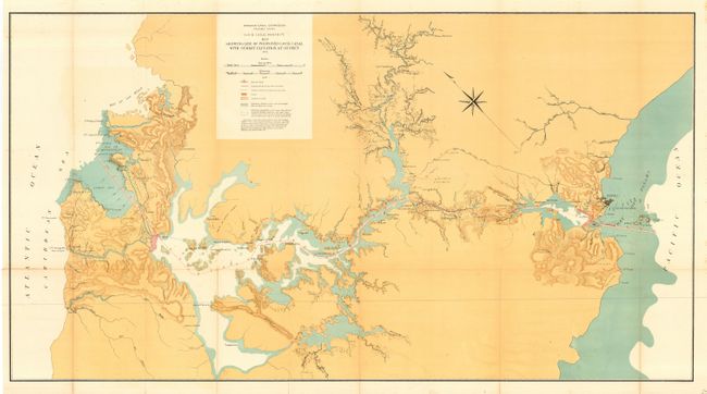
MapMaker: |
Anonymous
|
|
| |
| |
Subject: |
Panama |
|
| |
Period/Size: |
1906 / 26.5" x 48.7" (67.4 x 123.7 cm)
|
|
| |
Color: |
Colored
|
|
| |
Condition: |
(A) Issued folded now pressed and backed with archival tissue. Small fold split with archival tape on verso. Hint of toning along two folds, still very good for a map of this size and period. (condition help) |
|
| |
Source: |
Isthmian Canal Commission - Panama Canal |
|
| |
References: |
|
|
| |
|
|
| Sales Information |
| |
| |
Price: |
|
|
| |
| |
Offered by: |
Old World Auctions |
|
| |
Catalog: |
Auction No. 110 - Antique Maps, Charts, Atlases & Globes (386) |
|
| |
Lot/Item #: |
258 |
|
| |
| |
Date: |
03/2005
|
|
| |
| |
|