Title:
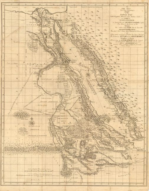
“To The King, This Map Containing a Chart of the Arabian Gulf With its Egyptian, Ethiopian and Arabian Coasts, from Suez to Babelmandeb…”
Map Maker:
James Bruce
Fascinating and intricately detailed map of the Re... (full text available to subscribers)
| Item Detail |
| |
| |
MapMaker: |
James Bruce
|
|
| |
| |
Subject: |
Egypt and Arabia |
|
| |
Period/Size: |
1868 / 24.5" x 19.5" (62.3 x 49.6 cm)
|
|
| |
Color: |
Black & White
|
|
| |
Condition: |
(B) Issued folding. General overall soil with several old paper repairs at fold intersections and a 4" binding tear. (condition help) |
|
| |
Source: |
Travels to Discover the Source of the Nile |
|
| |
References: |
|
|
| |
|
|
| Sales Information |
| |
| |
Price: |
|
|
| |
| |
Offered by: |
Old World Auctions |
|
| |
Catalog: |
Auction No. 111 - Antique Maps, Charts, Atlases & Globes (387) |
|
| |
Lot/Item #: |
682 |
|
| |
| |
Date: |
06/2005
|
|
| |
| |
|
Antique Maps - Valuation and Pricing, Descriptions, Resources |
|
Home |
Information |
Search |
Register |
Contact Us |
Site Map
Americana Exchange, Inc. © 1999 - 2024 Americana Exchange, Inc.. All rights reserved.
OldMaps.com, the OldMaps.com logo and
AMPR are service marks or registered service marks of Americana Exchange, Inc..
|