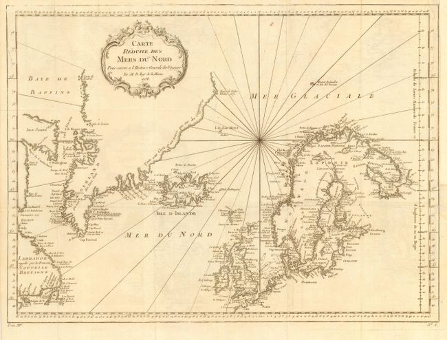
Title:
“Carte Reduite des Mers du Nord”
Map Maker:
Jacques Nicolas Bellin
Copper engraved chart centered roughly on Iceland.... (full text available to subscribers)
| Item Detail |
| |
| |
MapMaker: |
Jacques Nicolas Bellin
|
|
| |
| |
Subject: |
North Atlantic and Arctic Ocean |
|
| |
Period/Size: |
1758 / 13.0" x 17.7" (33.1 x 45.0 cm)
|
|
| |
Color: |
Black & White
|
|
| |
Condition: |
(A) Folding as issued with faint offsetting than can be easily erased. Margin extended at binding trim with repair on tiny binding tear into border. (condition help) |
|
| |
Source: |
Histoire Generale des Voyages |
|
| |
References: |
|
|
| |
|
|
| Sales Information |
| |
| |
Price: |
|
|
| |
| |
Offered by: |
Old World Auctions |
|
| |
Catalog: |
Auction No. 111 - Antique Maps, Charts, Atlases & Globes (387) |
|
| |
Lot/Item #: |
347 |
|
| |
| |
Date: |
06/2005
|
|
| |
| |
|
Antique Maps - Valuation and Pricing, Descriptions, Resources |
|
Home |
Information |
Search |
Register |
Contact Us |
Site Map
Americana Exchange, Inc. © 1999 - 2024 Americana Exchange, Inc.. All rights reserved.
OldMaps.com, the OldMaps.com logo and
AMPR are service marks or registered service marks of Americana Exchange, Inc..
|