Title:
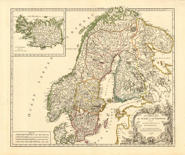
“Les Royaumes de Suede et de Norwege, divise en Leurs Provinces ou Gouvernemens…”
Map Maker:
Robert de Vaugondy [Family]
Large and beautifully engraved chart of Sweden, No... (full text available to subscribers)
| Item Detail |
| |
| |
MapMaker: |
Robert de Vaugondy [Family]
|
|
| |
| |
Subject: |
Scandinavia |
|
| |
Period/Size: |
1756 / 18.7" x 22.5" (47.5 x 57.2 cm)
|
|
| |
Color: |
Colored
|
|
| |
Condition: |
(A+) Dark, early impression on thick hand laid paper with very wide, original margins and several watermarks. (condition help) |
|
| |
Source: |
|
|
| |
References: |
Pedley #68 |
|
| |
|
|
| Sales Information |
| |
| |
Price: |
|
|
| |
| |
Offered by: |
Old World Auctions |
|
| |
Catalog: |
Auction No. 111 - Antique Maps, Charts, Atlases & Globes (387) |
|
| |
Lot/Item #: |
398 |
|
| |
| |
Date: |
06/2005
|
|
| |
| |
|
Antique Maps - Valuation and Pricing, Descriptions, Resources |
|
Home |
Information |
Search |
Register |
Contact Us |
Site Map
Americana Exchange, Inc. © 1999 - 2024 Americana Exchange, Inc.. All rights reserved.
OldMaps.com, the OldMaps.com logo and
AMPR are service marks or registered service marks of Americana Exchange, Inc..
|