| Item Detail |
| |
| |
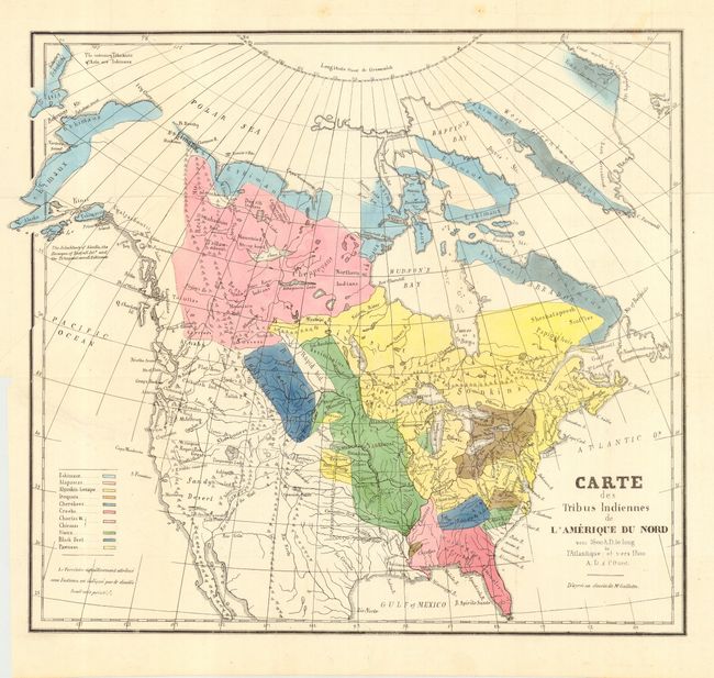
MapMaker: |
Albert Gallatin
|
|
| |
| |
Subject: |
North America |
|
| |
Period/Size: |
1836 / 14.6" x 16.3" (37.1 x 41.4 cm)
|
|
| |
Color: |
Colored
|
|
| |
Condition: |
(A) Lovely impression and original coloring. Full original margins with binding trim at left, as issued. Folding, as issued. Tear from binding trim into the Pacific, professional closed on verso and not visible on recto, else fine. (condition help) |
|
| |
Source: |
|
|
| |
References: |
Wheat (TMW) #417. |
|
| |
|
|
| Sales Information |
| |
| |
Price: |
|
|
| |
| |
Offered by: |
Old World Auctions |
|
| |
Catalog: |
Auction No. 111 - Antique Maps, Charts, Atlases & Globes (387) |
|
| |
Lot/Item #: |
080 |
|
| |
| |
Date: |
06/2005
|
|
| |
| |
|