| Item Detail |
| |
| |
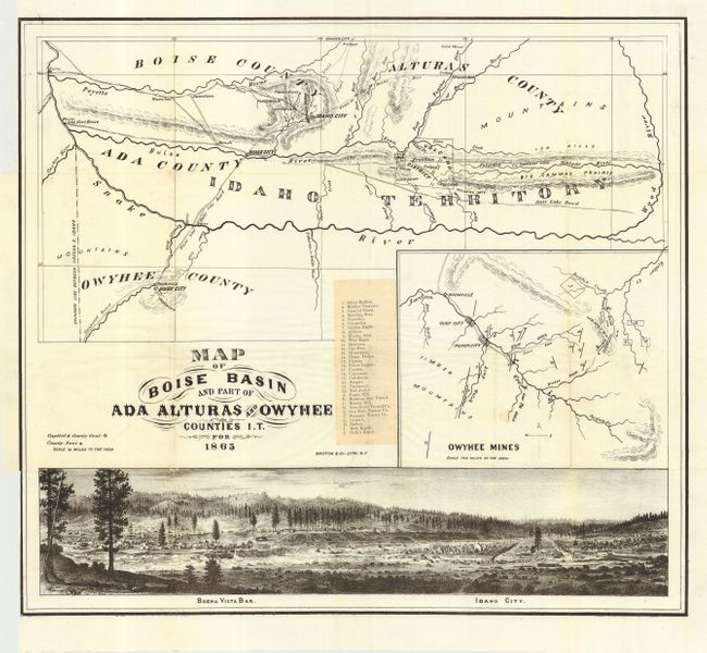
MapMaker: |
Britton & Co.
|
|
| |
| |
Subject: |
Idaho |
|
| |
Period/Size: |
1865 / 15.0" x 17.0" (38.1 x 43.2 cm)
|
|
| |
Color: |
Black & White
|
|
| |
Condition: |
(A) Clean and bright example with full margins on thin banknote style paper. Folding, as issued, with binding trim at left just to neatline. A couple of tiny holes at fold intersections, visible when held to light, still very good. (condition help) |
|
| |
Source: |
|
|
| |
References: |
Wheat (TMW) 1127 |
|
| |
|
|
| Sales Information |
| |
| |
Price: |
|
|
| |
| |
Offered by: |
Old World Auctions |
|
| |
Catalog: |
Auction No. 111 - Antique Maps, Charts, Atlases & Globes (387) |
|
| |
Lot/Item #: |
209 |
|
| |
| |
Date: |
06/2005
|
|
| |
| |
|