Title:
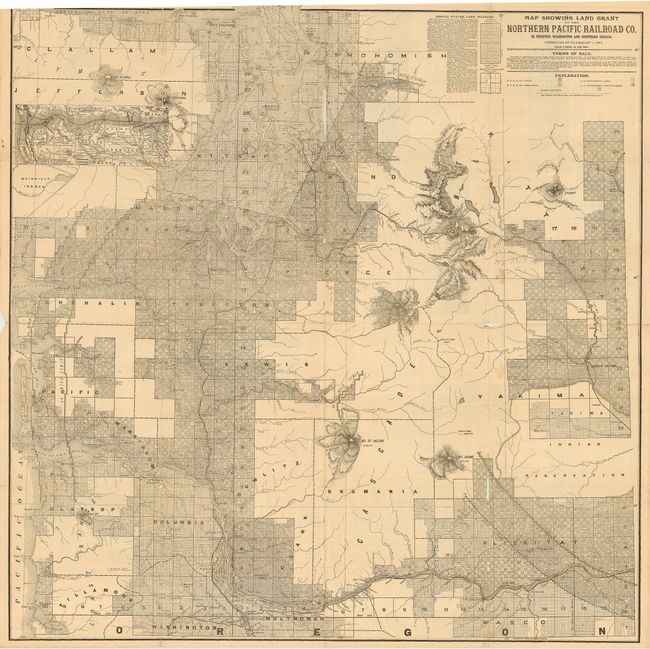
“Map Showing Land Grant of the Northern Pacific Railroad Co. in Western Washington and Northern Oregon. Corrected up to January 1, 1887.”
Map Maker:
Matthews-Northrup Co
Large, remarkably detailed map that shows all of P... (full text available to subscribers)
| Item Detail |
| |
| |
MapMaker: |
Matthews-Northrup Co
|
|
| |
| |
Subject: |
United States - Northwestern |
|
| |
Period/Size: |
1887 / 31.5" x 31.5" (80.1 x 80.1 cm)
|
|
| |
Color: |
Colored
|
|
| |
Condition: |
(C) Map is generally very good with pleasant age toning. Several splits at fold intersections and two clean tears in body of map. A rare issue that will benefit from professional conservation. Our image cuts off top border in error - all margins exists (condition help) |
|
| |
Source: |
|
|
| |
References: |
cf Rumsey 5392B. |
|
| |
|
|
| Sales Information |
| |
| |
Price: |
|
|
| |
| |
Offered by: |
Old World Auctions |
|
| |
Catalog: |
Auction No. 111 - Antique Maps, Charts, Atlases & Globes (387) |
|
| |
Lot/Item #: |
170 |
|
| |
| |
Date: |
06/2005
|
|
| |
| |
|
Antique Maps - Valuation and Pricing, Descriptions, Resources |
|
Home |
Information |
Search |
Register |
Contact Us |
Site Map
Americana Exchange, Inc. © 1999 - 2024 Americana Exchange, Inc.. All rights reserved.
OldMaps.com, the OldMaps.com logo and
AMPR are service marks or registered service marks of Americana Exchange, Inc..
|