| Item Detail |
| |
| |
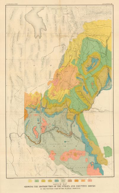
MapMaker: |
Clarence Edward Dutton
|
|
| |
| |
Subject: |
Arizona & Utah |
|
| |
Period/Size: |
1881 / 28.5" x 17.8" (72.4 x 45.3 cm)
|
|
| |
Color: |
Colored
|
|
| |
Condition: |
(A) Brilliant color, strong impression and full margins. Small area of light water stain at one fold intersection and two small splits at fold intersections, still very good. Folding, as issued. (condition help) |
|
| |
Source: |
Second Annual Report fo the U.S. Geological Survey |
|
| |
References: |
|
|
| |
|
|
| Sales Information |
| |
| |
Price: |
|
|
| |
| |
Offered by: |
Old World Auctions |
|
| |
Catalog: |
Auction No. 111 - Antique Maps, Charts, Atlases & Globes (387) |
|
| |
Lot/Item #: |
181 |
|
| |
| |
Date: |
06/2005
|
|
| |
| |
|