Title:
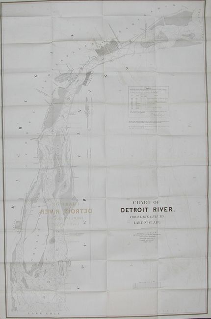
“Chart of Detroit River from Lake Erie to Lake St. Clair. Surveyed in 1840, '41 & 42 By Lieutenants J.N. Macomb and W.H. Warner…Under the Direction of Captain W.G. Williams”
Map Maker:
U.S. War Department
Very detailed map that includes a street plan of D... (full text available to subscribers)
| Item Detail |
| |
| |
MapMaker: |
U.S. War Department
|
|
| |
| |
Subject: |
Michigan |
|
| |
Period/Size: |
1844 / 45.0" x 29.0" (114.3 x 73.7 cm)
|
|
| |
Color: |
Black & White
|
|
| |
Condition: |
(B) Clean and crisp map with offsetting, else fine. (condition help) |
|
| |
Source: |
Sen. Doc 401, 28th Cong., 1st Sess. |
|
| |
References: |
|
|
| |
|
|
| Sales Information |
| |
| |
Price: |
|
|
| |
| |
Offered by: |
Old World Auctions |
|
| |
Catalog: |
Auction No. 111 - Antique Maps, Charts, Atlases & Globes (387) |
|
| |
Lot/Item #: |
224 |
|
| |
| |
Date: |
06/2005
|
|
| |
| |
|
Antique Maps - Valuation and Pricing, Descriptions, Resources |
|
Home |
Information |
Search |
Register |
Contact Us |
Site Map
Americana Exchange, Inc. © 1999 - 2024 Americana Exchange, Inc.. All rights reserved.
OldMaps.com, the OldMaps.com logo and
AMPR are service marks or registered service marks of Americana Exchange, Inc..
|