Title:
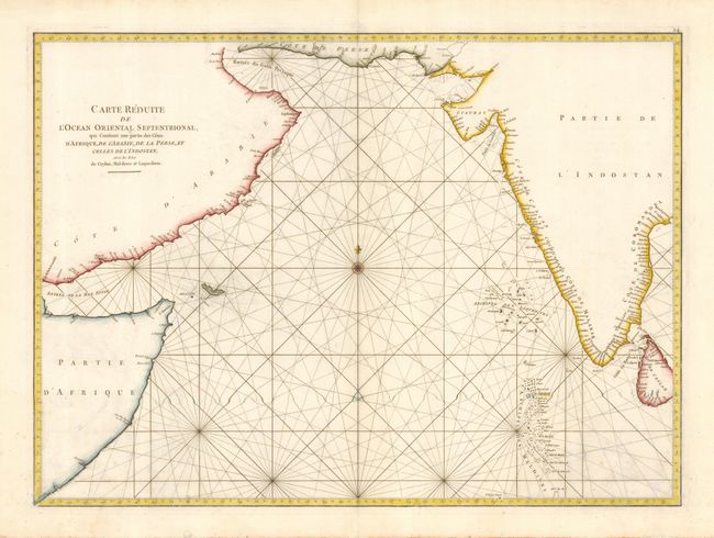
“Carte Reduite de l'Ocean Oriental Septentrional, qui Contient une partie des Cotes d'Afrique, de l'Arabie, de la Perse, et celles de l' Indostan, avec les Isles de Ceylon, Maldives et Laquedives”
Map Maker:
Jean B.N.D. d' Apres de Mannevillette
Large-scale sea chart covering the northern Indian... (full text available to subscribers)
| Item Detail |
| |
| |
MapMaker: |
Jean B.N.D. d' Apres de Mannevillette
|
|
| |
| |
Subject: |
Indian Ocean |
|
| |
Period/Size: |
1775 / 18.8" x 26.0" (47.8 x 66.1 cm)
|
|
| |
Color: |
Colored
|
|
| |
Condition: |
(B) Printed on heavy paper. Light damp stains in lower corners with a few spots. (condition help) |
|
| |
Source: |
Le Neptune Oriental |
|
| |
References: |
|
|
| |
|
|
| Sales Information |
| |
| |
Price: |
|
|
| |
| |
Offered by: |
Old World Auctions |
|
| |
Catalog: |
Auction No. 111 - Antique Maps, Charts, Atlases & Globes (387) |
|
| |
Lot/Item #: |
645 |
|
| |
| |
Date: |
06/2005
|
|
| |
| |
|
Antique Maps - Valuation and Pricing, Descriptions, Resources |
|
Home |
Information |
Search |
Register |
Contact Us |
Site Map
Americana Exchange, Inc. © 1999 - 2024 Americana Exchange, Inc.. All rights reserved.
OldMaps.com, the OldMaps.com logo and
AMPR are service marks or registered service marks of Americana Exchange, Inc..
|