Title:
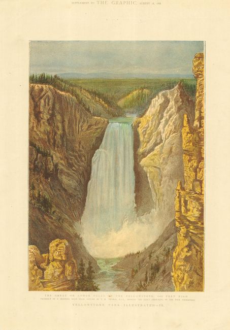
“The Great or Lower Falls of the Yellowstone, 360 Feet High. Facsimile of a Drawing made from Nature by T.H. Thomas. R.C.A., Showing the Exact Colouring of the Rock Formations”
This fabulous chromolithograph was published in a ... (full text available to subscribers)
| Item Detail |
| |
| |
MapMaker: |
(none given)
|
|
| |
| |
Subject: |
Wyoming - Yellowstone |
|
| |
Period/Size: |
1888 / 12.0" x 8.5" (30.5 x 21.6 cm)
|
|
| |
Color: |
Colored
|
|
| |
Condition: |
(A) Nice impression with no flaws. One tiny spot in title, image fine. (condition help) |
|
| |
Source: |
The Graphic |
|
| |
References: |
|
|
| |
|
|
| Sales Information |
| |
| |
Price: |
|
|
| |
| |
Offered by: |
Old World Auctions |
|
| |
Catalog: |
Auction No. 111 - Antique Maps, Charts, Atlases & Globes (387) |
|
| |
Lot/Item #: |
271 |
|
| |
| |
Date: |
06/2005
|
|
| |
| |
|
Antique Maps - Valuation and Pricing, Descriptions, Resources |
|
Home |
Information |
Search |
Register |
Contact Us |
Site Map
Americana Exchange, Inc. © 1999 - 2024 Americana Exchange, Inc.. All rights reserved.
OldMaps.com, the OldMaps.com logo and
AMPR are service marks or registered service marks of Americana Exchange, Inc..
|