Title:
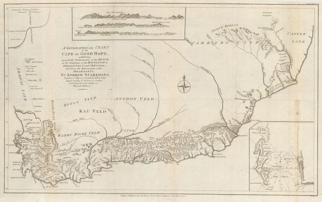
“A Geographical Chart of the Cape of Good Hope, exhibiting as well the Settlements of the Dutch, as the Stations of the Hottentots, delineated from Actual Observation, and from the Information of the Inhabitants”
Map Maker:
Andrew Sparrmans
Sparrmans' map is a milestone in the history of So... (full text available to subscribers)
| Item Detail |
| |
| |
MapMaker: |
Andrew Sparrmans
|
|
| |
| |
Subject: |
Southern Africa |
|
| |
Period/Size: |
1785 / 13.0" x 21.0" (33.1 x 53.4 cm)
|
|
| |
Color: |
Black & White
|
|
| |
Condition: |
(B) Old paper flaw at lower right and a bit of minor soil. (condition help) |
|
| |
Source: |
Political Magazine |
|
| |
References: |
Jolly POL-93; Norwich #223. |
|
| |
|
|
| Sales Information |
| |
| |
Price: |
|
|
| |
| |
Offered by: |
Old World Auctions |
|
| |
Catalog: |
Auction No. 112 - Antique Maps, Charts, Atlases & Globes (565) |
|
| |
Lot/Item #: |
711 |
|
| |
| |
Date: |
09/2005
|
|
| |
| |
|
Antique Maps - Valuation and Pricing, Descriptions, Resources |
|
Home |
Information |
Search |
Register |
Contact Us |
Site Map
Americana Exchange, Inc. © 1999 - 2024 Americana Exchange, Inc.. All rights reserved.
OldMaps.com, the OldMaps.com logo and
AMPR are service marks or registered service marks of Americana Exchange, Inc..
|