Title:
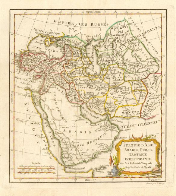
“Turquie d'Asie, Arabie, Perse, Tartarie Independante…”
Map Maker:
Robert de Vaugondy [Family]
Nicely engraved map with Arabia figuring prominent... (full text available to subscribers)
| Item Detail |
| |
| |
MapMaker: |
Robert de Vaugondy [Family]
|
|
| |
| |
Subject: |
Near and Middle East |
|
| |
Period/Size: |
1775 / 9.6" x 8.7" (24.4 x 22.1 cm)
|
|
| |
Color: |
Colored
|
|
| |
Condition: |
(A) Good impression on thick hand laid paper. Original outline color in map with later color in cartouche. One small flaw on verso with thinning paper not visible from map side. (condition help) |
|
| |
Source: |
|
|
| |
References: |
|
|
| |
|
|
| Sales Information |
| |
| |
Price: |
|
|
| |
| |
Offered by: |
Old World Auctions |
|
| |
Catalog: |
Auction No. 112 - Antique Maps, Charts, Atlases & Globes (565) |
|
| |
Lot/Item #: |
602 |
|
| |
| |
Date: |
09/2005
|
|
| |
| |
|
Antique Maps - Valuation and Pricing, Descriptions, Resources |
|
Home |
Information |
Search |
Register |
Contact Us |
Site Map
Americana Exchange, Inc. © 1999 - 2024 Americana Exchange, Inc.. All rights reserved.
OldMaps.com, the OldMaps.com logo and
AMPR are service marks or registered service marks of Americana Exchange, Inc..
|