Title:
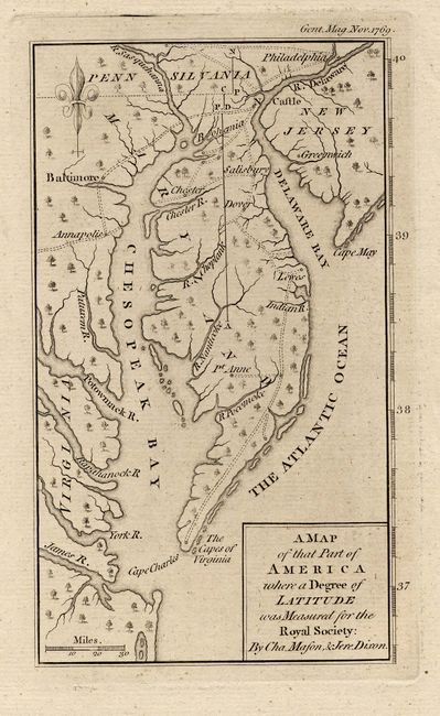
“A Map of that Part of America where a Degree of Latitude was Measured for the Royal Society: By Cha. Mason, & Jere. Dixon”
Map Maker:
Anonymous
Shows the Delaware peninsula north to Philadelphia... (full text available to subscribers)
| Item Detail |
| |
| |
MapMaker: |
Anonymous
|
|
| |
| |
Subject: |
Colonial Mid-Atlantic |
|
| |
Period/Size: |
1769 / 6.5" x 3.8" (16.6 x 9.7 cm)
|
|
| |
Color: |
Black & White
|
|
| |
Condition: |
(A+) (condition help) |
|
| |
Source: |
Gentleman's Magazine |
|
| |
References: |
Jolly GENT-199. |
|
| |
|
|
| Sales Information |
| |
| |
Price: |
|
|
| |
| |
Offered by: |
Old World Auctions |
|
| |
Catalog: |
Auction No. 112 - Antique Maps, Charts, Atlases & Globes (565) |
|
| |
Lot/Item #: |
165 |
|
| |
| |
Date: |
09/2005
|
|
| |
| |
|
Antique Maps - Valuation and Pricing, Descriptions, Resources |
|
Home |
Information |
Search |
Register |
Contact Us |
Site Map
Americana Exchange, Inc. © 1999 - 2024 Americana Exchange, Inc.. All rights reserved.
OldMaps.com, the OldMaps.com logo and
AMPR are service marks or registered service marks of Americana Exchange, Inc..
|