Title:
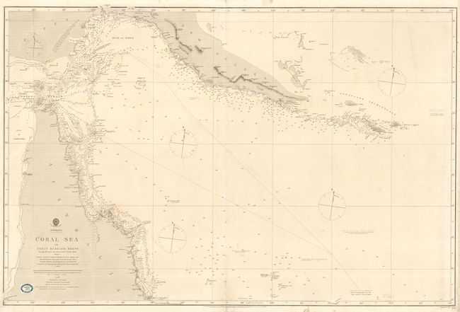
“Australia - Coral Sea and Great Barrier Reefs Shewing The Inner and Outer routes to Torres Strait”
Map Maker:
British Admiralty
Superb, large-scale sea chart detailing the northe... (full text available to subscribers)
| Item Detail |
| |
| |
MapMaker: |
British Admiralty
|
|
| |
| |
Subject: |
Australia |
|
| |
Period/Size: |
1863 / 28.8" x 38.8" (73.2 x 98.6 cm)
|
|
| |
Color: |
Black & White
|
|
| |
Condition: |
(B) Light general overall soil. 8" long tear at right and a couple other minor tears all professionally repaired with Japanese tissue on verso. Course of a ship in pencil dated 1865. (condition help) |
|
| |
Source: |
|
|
| |
References: |
|
|
| |
|
|
| Sales Information |
| |
| |
Price: |
|
|
| |
| |
Offered by: |
Old World Auctions |
|
| |
Catalog: |
Auction No. 112 - Antique Maps, Charts, Atlases & Globes (565) |
|
| |
Lot/Item #: |
724 |
|
| |
| |
Date: |
09/2005
|
|
| |
| |
|
Antique Maps - Valuation and Pricing, Descriptions, Resources |
|
Home |
Information |
Search |
Register |
Contact Us |
Site Map
Americana Exchange, Inc. © 1999 - 2024 Americana Exchange, Inc.. All rights reserved.
OldMaps.com, the OldMaps.com logo and
AMPR are service marks or registered service marks of Americana Exchange, Inc..
|