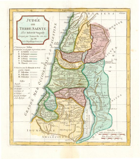
Title:
“Judee ou Terre Sainte”
Map Maker:
Didier Robert de Vaugondy
Nice copper engraved map of present day Israel and... (full text available to subscribers)
| Item Detail |
| |
| |
MapMaker: |
Didier Robert de Vaugondy
|
|
| |
| |
Subject: |
Holy Land |
|
| |
Period/Size: |
1778 / 9.7" x 8.5" (24.7 x 21.6 cm)
|
|
| |
Color: |
Colored
|
|
| |
Condition: |
(A) Clean and bright with fresh color. Faint damp stain in bottom margin. (condition help) |
|
| |
Source: |
Nouvel Atlas Portatif |
|
| |
References: |
Pedley #395. |
|
| |
|
|
| Sales Information |
| |
| |
Price: |
|
|
| |
| |
Offered by: |
Old World Auctions |
|
| |
Catalog: |
Auction No. 112 - Antique Maps, Charts, Atlases & Globes (565) |
|
| |
Lot/Item #: |
619 |
|
| |
| |
Date: |
09/2005
|
|
| |
| |
|
Antique Maps - Valuation and Pricing, Descriptions, Resources |
|
Home |
Information |
Search |
Register |
Contact Us |
Site Map
Americana Exchange, Inc. © 1999 - 2024 Americana Exchange, Inc.. All rights reserved.
OldMaps.com, the OldMaps.com logo and
AMPR are service marks or registered service marks of Americana Exchange, Inc..
|