Title:
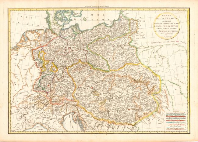
“Carte de l'Allemagne Contenant les Etats de la Confederation du Rhin Le Royaume de Prusse le Grand Duchy de Warsovie et l'Empire d'Autriche”
Map Maker:
Felix Delamarche
Finely detailed map of central Europe showing the ... (full text available to subscribers)
| Item Detail |
| |
| |
MapMaker: |
Felix Delamarche
|
|
| |
| |
Subject: |
Central Europe |
|
| |
Period/Size: |
1806 / 19.5" x 28.3" (49.6 x 71.9 cm)
|
|
| |
Color: |
Colored
|
|
| |
Condition: |
(A) Toned at paper edges with a few short tears, not affecting map. (condition help) |
|
| |
Source: |
|
|
| |
References: |
|
|
| |
|
|
| Sales Information |
| |
| |
Price: |
|
|
| |
| |
Offered by: |
Old World Auctions |
|
| |
Catalog: |
Auction No. 113 - Antique Maps, Charts, Atlases & Globes (566) |
|
| |
Lot/Item #: |
474 |
|
| |
| |
Date: |
12/2005
|
|
| |
| |
|
Antique Maps - Valuation and Pricing, Descriptions, Resources |
|
Home |
Information |
Search |
Register |
Contact Us |
Site Map
Americana Exchange, Inc. © 1999 - 2024 Americana Exchange, Inc.. All rights reserved.
OldMaps.com, the OldMaps.com logo and
AMPR are service marks or registered service marks of Americana Exchange, Inc..
|