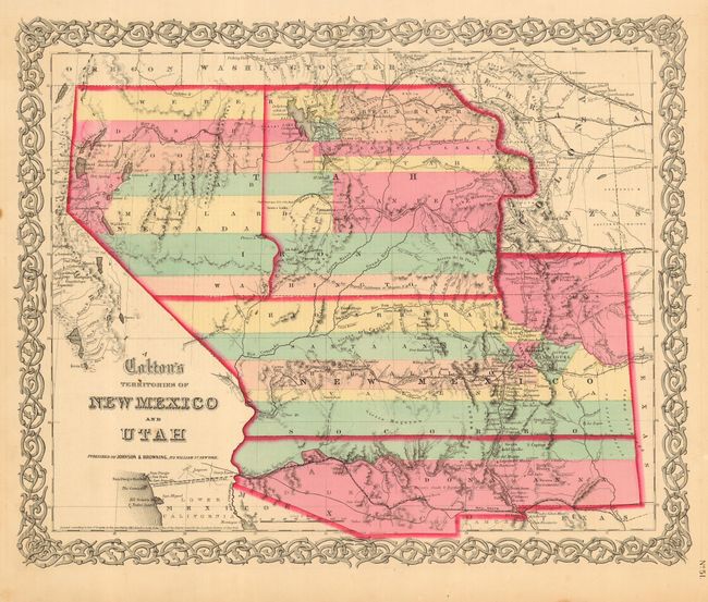
Title:
“Colton's Territories of New Mexico and Utah”
Map Maker:
Johnson & Browning
This is the scarce issue of Colton's great map of ... (full text available to subscribers)
| Item Detail |
| |
| |
MapMaker: |
Johnson & Browning
|
|
| |
| |
Subject: |
Southwestern United States |
|
| |
Period/Size: |
1860 / 13.0" x 16.0" (33.1 x 40.7 cm)
|
|
| |
Color: |
Colored
|
|
| |
Condition: |
(A) Very fine impression and coloring with full margins. A couple marginal spots well away from image and border. (condition help) |
|
| |
Source: |
Illustrated Family Atlas |
|
| |
References: |
Wheat (TMW) #832; cf Phillips #816. |
|
| |
|
|
| Sales Information |
| |
| |
Price: |
|
|
| |
| |
Offered by: |
Old World Auctions |
|
| |
Catalog: |
Auction No. 112 - Antique Maps, Charts, Atlases & Globes (565) |
|
| |
Lot/Item #: |
204 |
|
| |
| |
Date: |
09/2005
|
|
| |
| |
|
Antique Maps - Valuation and Pricing, Descriptions, Resources |
|
Home |
Information |
Search |
Register |
Contact Us |
Site Map
Americana Exchange, Inc. © 1999 - 2024 Americana Exchange, Inc.. All rights reserved.
OldMaps.com, the OldMaps.com logo and
AMPR are service marks or registered service marks of Americana Exchange, Inc..
|