Title:
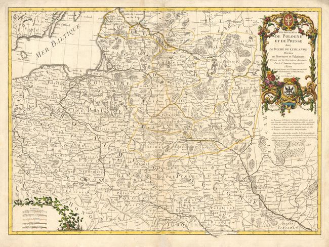
“Les Royaumes de Pologne et de Prusse avec le Duche de Curlande Divises en Provinces et Palatinats…”
Map Maker:
Janvier/Lattre
Beautiful, large map covering present-day Poland a... (full text available to subscribers)
| Item Detail |
| |
| |
MapMaker: |
Janvier/Lattre
|
|
| |
| |
Subject: |
Eastern Europe |
|
| |
Period/Size: |
1760 / 18.5" x 25.5" (47.0 x 64.8 cm)
|
|
| |
Color: |
Colored
|
|
| |
Condition: |
(B) Tissue repairs of fold separations and a bit of light surface soil. (condition help) |
|
| |
Source: |
Atlas Moderne |
|
| |
References: |
|
|
| |
|
|
| Sales Information |
| |
| |
Price: |
|
|
| |
| |
Offered by: |
Old World Auctions |
|
| |
Catalog: |
Auction No. 112 - Antique Maps, Charts, Atlases & Globes (565) |
|
| |
Lot/Item #: |
518 |
|
| |
| |
Date: |
09/2005
|
|
| |
| |
|
Antique Maps - Valuation and Pricing, Descriptions, Resources |
|
Home |
Information |
Search |
Register |
Contact Us |
Site Map
Americana Exchange, Inc. © 1999 - 2024 Americana Exchange, Inc.. All rights reserved.
OldMaps.com, the OldMaps.com logo and
AMPR are service marks or registered service marks of Americana Exchange, Inc..
|