Title:
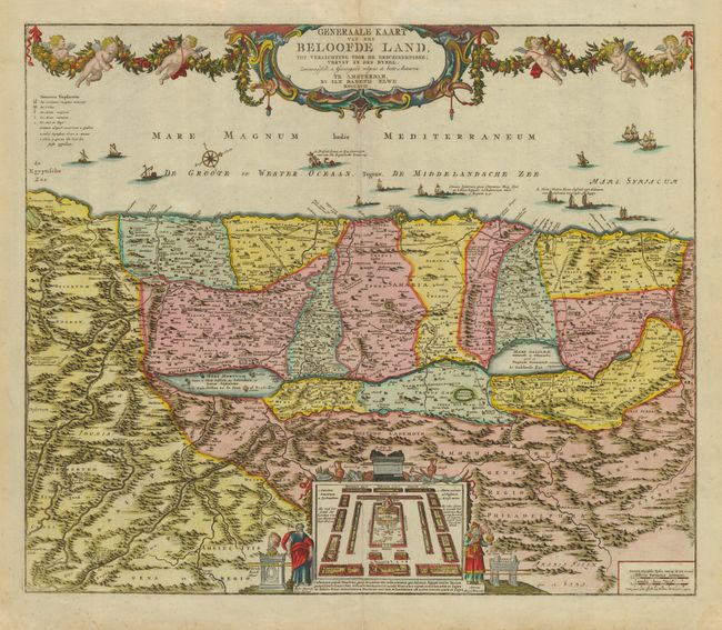
“Generaale Kaart van het Beloofde Land tot Verlichting Voor de Geschiedenisse…”
Map Maker:
Jan Barend Elwe
Large, detailed map of the Holy Land based on De W... (full text available to subscribers)
| Item Detail |
| |
| |
MapMaker: |
Jan Barend Elwe
|
|
| |
| |
Subject: |
Holy Land |
|
| |
Period/Size: |
1792 / 20.0" x 23.5" (50.8 x 59.7 cm)
|
|
| |
Color: |
Colored
|
|
| |
Condition: |
(A) Overall very good with a bit of light foxing, mostly confined to blank margins. Tissue repair of short fold separations. (condition help) |
|
| |
Source: |
|
|
| |
References: |
Laor #268. |
|
| |
|
|
| Sales Information |
| |
| |
Price: |
|
|
| |
| |
Offered by: |
Old World Auctions |
|
| |
Catalog: |
Auction No. 112 - Antique Maps, Charts, Atlases & Globes (565) |
|
| |
Lot/Item #: |
620 |
|
| |
| |
Date: |
09/2005
|
|
| |
| |
|
Antique Maps - Valuation and Pricing, Descriptions, Resources |
|
Home |
Information |
Search |
Register |
Contact Us |
Site Map
Americana Exchange, Inc. © 1999 - 2024 Americana Exchange, Inc.. All rights reserved.
OldMaps.com, the OldMaps.com logo and
AMPR are service marks or registered service marks of Americana Exchange, Inc..
|