Title:
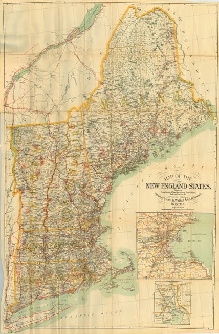
“Map of the New England States Showing State, County & Town Boundaries, Post Offices, Railroad Stations &c.”
Map Maker:
George H. Walker [& Co.]
Large and colorful pocket map folding into origina... (full text available to subscribers)
| Item Detail |
| |
| |
MapMaker: |
George H. Walker [& Co.]
|
|
| |
| |
Subject: |
New England |
|
| |
Period/Size: |
1894 / 41.5" x 26.5" (105.5 x 67.4 cm)
|
|
| |
Color: |
Colored
|
|
| |
Condition: |
(B) Some fold intersection splits, and some longer splits along one fold, else very good. Front cover has some red stains. (condition help) |
|
| |
Source: |
|
|
| |
References: |
|
|
| |
|
|
| Sales Information |
| |
| |
Price: |
|
|
| |
| |
Offered by: |
Old World Auctions |
|
| |
Catalog: |
Auction No. 112 - Antique Maps, Charts, Atlases & Globes (565) |
|
| |
Lot/Item #: |
163 |
|
| |
| |
Date: |
09/2005
|
|
| |
| |
|
Antique Maps - Valuation and Pricing, Descriptions, Resources |
|
Home |
Information |
Search |
Register |
Contact Us |
Site Map
Americana Exchange, Inc. © 1999 - 2024 Americana Exchange, Inc.. All rights reserved.
OldMaps.com, the OldMaps.com logo and
AMPR are service marks or registered service marks of Americana Exchange, Inc..
|