Title:
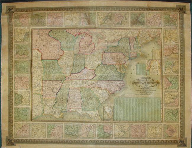
“Mitchell's National Map of the American Republic of United States of North America, Together with maps of the Vicinities of Thirty-Two of the Principal Cities and Towns…”
Map Maker:
Samuel Augustus Mitchell
A very handsome example of an increasingly hard to... (full text available to subscribers)
| Item Detail |
| |
| |
MapMaker: |
Samuel Augustus Mitchell
|
|
| |
| |
Subject: |
Eastern United States |
|
| |
Period/Size: |
1844 / 36.0" x 45.8" (91.5 x 116.4 cm)
|
|
| |
Color: |
Colored
|
|
| |
Condition: |
(A) Very slight damp stain in top border and a few spots, else near mint. Both rollers present, but the bottom roller is detached. (condition help) |
|
| |
Source: |
|
|
| |
References: |
|
|
| |
|
|
| Sales Information |
| |
| |
Price: |
|
|
| |
| |
Offered by: |
Old World Auctions |
|
| |
Catalog: |
Auction No. 112 - Antique Maps, Charts, Atlases & Globes (565) |
|
| |
Lot/Item #: |
154 |
|
| |
| |
Date: |
09/2005
|
|
| |
| |
|
Antique Maps - Valuation and Pricing, Descriptions, Resources |
|
Home |
Information |
Search |
Register |
Contact Us |
Site Map
Americana Exchange, Inc. © 1999 - 2024 Americana Exchange, Inc.. All rights reserved.
OldMaps.com, the OldMaps.com logo and
AMPR are service marks or registered service marks of Americana Exchange, Inc..
|