Title:
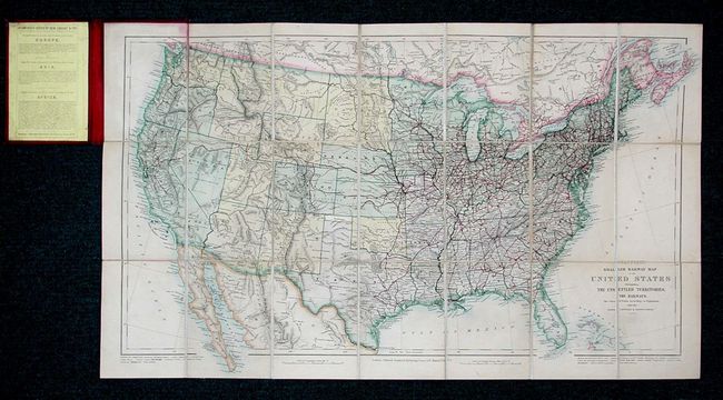
“Stanford's Smaller Railway Map of the United States Distinguishing the Unsettled Territories; The Railways; The Cities and Towns According to Population; Also the State Capitals, & County Towns”
Map Maker:
Edward Stanford
Very uncommon pocket map of the United States with... (full text available to subscribers)
| Item Detail |
| |
| |
MapMaker: |
Edward Stanford
|
|
| |
| |
Subject: |
United States |
|
| |
Period/Size: |
1875 / 16.0" x 28.5" (40.7 x 72.4 cm)
|
|
| |
Color: |
Colored
|
|
| |
Condition: |
(A) Covers and linen damp stained, but map very good. Corners bumped with cloth fraying on spine. Overall very good for this type of map. (condition help) |
|
| |
Source: |
|
|
| |
References: |
Manasek #119. |
|
| |
|
|
| Sales Information |
| |
| |
Price: |
|
|
| |
| |
Offered by: |
Old World Auctions |
|
| |
Catalog: |
Auction No. 113 - Antique Maps, Charts, Atlases & Globes (566) |
|
| |
Lot/Item #: |
158 |
|
| |
| |
Date: |
12/2005
|
|
| |
| |
|
Antique Maps - Valuation and Pricing, Descriptions, Resources |
|
Home |
Information |
Search |
Register |
Contact Us |
Site Map
Americana Exchange, Inc. © 1999 - 2024 Americana Exchange, Inc.. All rights reserved.
OldMaps.com, the OldMaps.com logo and
AMPR are service marks or registered service marks of Americana Exchange, Inc..
|