Title:
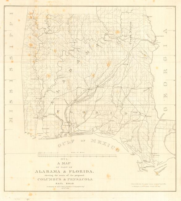
“No. 1 A Map of Part of Alabama & Florida shewing the route of the proposed Columbus & Pensacola Rail Road”
Map Maker:
U.S. Corps of Engineers
An early and notable railroad map of parts of sout... (full text available to subscribers)
| Item Detail |
| |
| |
MapMaker: |
U.S. Corps of Engineers
|
|
| |
| |
Subject: |
Southern United States |
|
| |
Period/Size: |
1836 / 22.0" x 20.5" (55.9 x 52.1 cm)
|
|
| |
Color: |
Black & White
|
|
| |
Condition: |
(B) Issued folding, now backed with archival tissue. Occasional scattered foxing. (condition help) |
|
| |
Source: |
HR Doc. No. 176 |
|
| |
References: |
Clausen & Friis #125; Modelski (Railroads) #388. |
|
| |
|
|
| Sales Information |
| |
| |
Price: |
|
|
| |
| |
Offered by: |
Old World Auctions |
|
| |
Catalog: |
Auction No. 113 - Antique Maps, Charts, Atlases & Globes (566) |
|
| |
Lot/Item #: |
186 |
|
| |
| |
Date: |
12/2005
|
|
| |
| |
|
Antique Maps - Valuation and Pricing, Descriptions, Resources |
|
Home |
Information |
Search |
Register |
Contact Us |
Site Map
Americana Exchange, Inc. © 1999 - 2024 Americana Exchange, Inc.. All rights reserved.
OldMaps.com, the OldMaps.com logo and
AMPR are service marks or registered service marks of Americana Exchange, Inc..
|