Title:
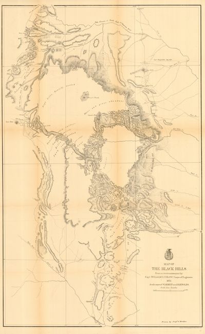
“Map of the Black Hills from a reconnaissance by Capt. William Ludlow, Corps of Engineers”
Map Maker:
U.S. War Department
A large map drawn by Sergeant C. Becker and one of... (full text available to subscribers)
| Item Detail |
| |
| |
MapMaker: |
U.S. War Department
|
|
| |
| |
Subject: |
Dakota Territory |
|
| |
Period/Size: |
1874 / 38.0" x 23.5" (96.6 x 59.7 cm)
|
|
| |
Color: |
Black & White
|
|
| |
Condition: |
(B) Issue folding, now backed with archival tissue. Some light toning on folds. (condition help) |
|
| |
Source: |
Report of a Reconnaissance of the Black Hills of Dakota |
|
| |
References: |
Wheat (TMW) #1249. |
|
| |
|
|
| Sales Information |
| |
| |
Price: |
|
|
| |
| |
Offered by: |
Old World Auctions |
|
| |
Catalog: |
Auction No. 113 - Antique Maps, Charts, Atlases & Globes (566) |
|
| |
Lot/Item #: |
235 |
|
| |
| |
Date: |
12/2005
|
|
| |
| |
|
Antique Maps - Valuation and Pricing, Descriptions, Resources |
|
Home |
Information |
Search |
Register |
Contact Us |
Site Map
Americana Exchange, Inc. © 1999 - 2024 Americana Exchange, Inc.. All rights reserved.
OldMaps.com, the OldMaps.com logo and
AMPR are service marks or registered service marks of Americana Exchange, Inc..
|