Title:
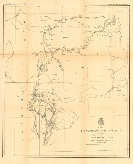
“Map of a Reconnaissance of the Black Hills, July and August, 1874, with troops under the command of Lt. Col. G. A. Custer, 7th Cavalry. By Capt. Wm. Ludlow, Corps of Engineers.”
Map Maker:
U.S. War Department
This is Ludlow's principle map that shows the enti... (full text available to subscribers)
| Item Detail |
| |
| |
MapMaker: |
U.S. War Department
|
|
| |
| |
Subject: |
Dakota Territory |
|
| |
Period/Size: |
1874 / 25.5" x 21.3" (64.8 x 54.1 cm)
|
|
| |
Color: |
Black & White
|
|
| |
Condition: |
(B) Issued folding, now pressed and backed with archival tissue. A little light toning along two folds, else very good. (condition help) |
|
| |
Source: |
Report of a Reconnaissance of the Black Hills of Dakota |
|
| |
References: |
Wheat (TMW) #1248. |
|
| |
|
|
| Sales Information |
| |
| |
Price: |
|
|
| |
| |
Offered by: |
Old World Auctions |
|
| |
Catalog: |
Auction No. 113 - Antique Maps, Charts, Atlases & Globes (566) |
|
| |
Lot/Item #: |
234 |
|
| |
| |
Date: |
12/2005
|
|
| |
| |
|
Antique Maps - Valuation and Pricing, Descriptions, Resources |
|
Home |
Information |
Search |
Register |
Contact Us |
Site Map
Americana Exchange, Inc. © 1999 - 2024 Americana Exchange, Inc.. All rights reserved.
OldMaps.com, the OldMaps.com logo and
AMPR are service marks or registered service marks of Americana Exchange, Inc..
|