| Item Detail |
| |
| |
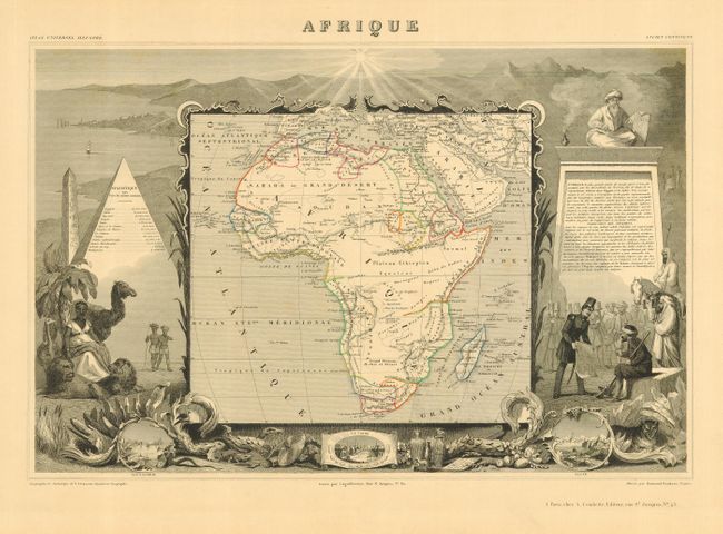
MapMaker: |
Victor Levasseur
|
|
| |
| |
Subject: |
Africa |
|
| |
Period/Size: |
1845 / 11.0" x 17.2" (28.0 x 43.7 cm)
|
|
| |
Color: |
Colored
|
|
| |
Condition: |
(A+) A very early impression with the guide lines are still visible bounding the engraved text. Full margins. One tiny and light spot, still fine. Small embossed owners stamp in lower blank margin. (condition help) |
|
| |
Source: |
Atlas National Illustre |
|
| |
References: |
Norwich #140. |
|
| |
|
|
| Sales Information |
| |
| |
Price: |
|
|
| |
| |
Offered by: |
Old World Auctions |
|
| |
Catalog: |
Auction No. 113 - Antique Maps, Charts, Atlases & Globes (566) |
|
| |
Lot/Item #: |
768 |
|
| |
| |
Date: |
12/2005
|
|
| |
| |
|