Title:
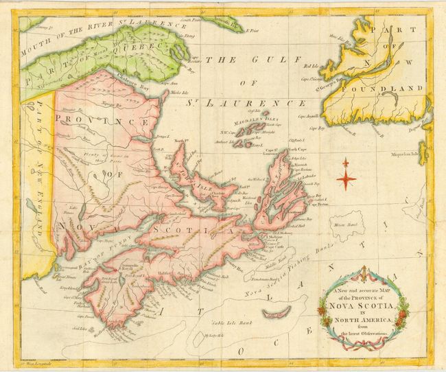
“A New and Accurate Map of the Province of Nova Scotia, in North America; from the latest Observations”
Map Maker:
Anonymous
This small map covers Prince Edward Island, New Br... (full text available to subscribers)
| Item Detail |
| |
| |
MapMaker: |
Anonymous
|
|
| |
| |
Subject: |
Canada |
|
| |
Period/Size: |
1781 / 11.0" x 13.0" (28.0 x 33.1 cm)
|
|
| |
Color: |
Colored
|
|
| |
Condition: |
(B) Issued folded now pressed with some residual creasing. Margin extended at binding trim with 1" tear repaired. (condition help) |
|
| |
Source: |
Universal Magazine |
|
| |
References: |
Jolly UNIV-192; Kershaw #803; Seller and Van Ee #319. |
|
| |
|
|
| Sales Information |
| |
| |
Price: |
|
|
| |
| |
Offered by: |
Old World Auctions |
|
| |
Catalog: |
Auction No. 113 - Antique Maps, Charts, Atlases & Globes (566) |
|
| |
Lot/Item #: |
125 |
|
| |
| |
Date: |
12/2005
|
|
| |
| |
|
Antique Maps - Valuation and Pricing, Descriptions, Resources |
|
Home |
Information |
Search |
Register |
Contact Us |
Site Map
Americana Exchange, Inc. © 1999 - 2024 Americana Exchange, Inc.. All rights reserved.
OldMaps.com, the OldMaps.com logo and
AMPR are service marks or registered service marks of Americana Exchange, Inc..
|