Title:
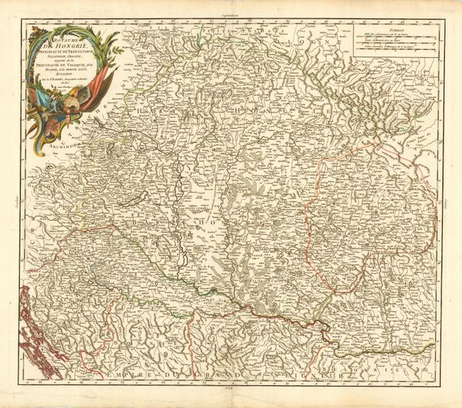
“Royaume de Hongrie, Principaute de Transilvanie, Sclavonie, Croatie, et partie de la Principaute de Valaquie, de la Bosnie, de la Servie et de la Bulgarie”
Map Maker:
Gilles Robert de Vaugondy
Copper engraved map with strong detail throughout ... (full text available to subscribers)
| Item Detail |
| |
| |
MapMaker: |
Gilles Robert de Vaugondy
|
|
| |
| |
Subject: |
Southeastern Europe |
|
| |
Period/Size: |
1751 / 18.6" x 21.6" (47.3 x 54.9 cm)
|
|
| |
Color: |
Colored
|
|
| |
Condition: |
(A+) Fine impression and color. Bit of light surface soil in bottom blank margin. (condition help) |
|
| |
Source: |
|
|
| |
References: |
Pedley #288. |
|
| |
|
|
| Sales Information |
| |
| |
Price: |
|
|
| |
| |
Offered by: |
Old World Auctions |
|
| |
Catalog: |
Auction No. 113 - Antique Maps, Charts, Atlases & Globes (566) |
|
| |
Lot/Item #: |
564 |
|
| |
| |
Date: |
12/2005
|
|
| |
| |
|
Antique Maps - Valuation and Pricing, Descriptions, Resources |
|
Home |
Information |
Search |
Register |
Contact Us |
Site Map
Americana Exchange, Inc. © 1999 - 2024 Americana Exchange, Inc.. All rights reserved.
OldMaps.com, the OldMaps.com logo and
AMPR are service marks or registered service marks of Americana Exchange, Inc..
|