Title:
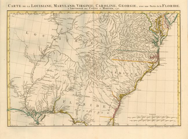
“Carte de la Louisiane, Maryland, Virginie, Caroline, Georgie, avec une Partie de la Floride”
Map Maker:
Covens & Mortier
Detailed map of the Southeast covering from Delawa... (full text available to subscribers)
| Item Detail |
| |
| |
MapMaker: |
Covens & Mortier
|
|
| |
| |
Subject: |
Colonial Southeast |
|
| |
Period/Size: |
1758 / 16.4" x 23.0" (41.7 x 58.5 cm)
|
|
| |
Color: |
Colored
|
|
| |
Condition: |
(A+) Fine impression and original outline color. (condition help) |
|
| |
Source: |
Atlas Nouveau Contenant… |
|
| |
References: |
Cumming (SE) #316; Sellers and Van Ee #1386. |
|
| |
|
|
| Sales Information |
| |
| |
Price: |
|
|
| |
| |
Offered by: |
Old World Auctions |
|
| |
Catalog: |
Auction No. 113 - Antique Maps, Charts, Atlases & Globes (566) |
|
| |
Lot/Item #: |
192 |
|
| |
| |
Date: |
12/2005
|
|
| |
| |
|
Antique Maps - Valuation and Pricing, Descriptions, Resources |
|
Home |
Information |
Search |
Register |
Contact Us |
Site Map
Americana Exchange, Inc. © 1999 - 2024 Americana Exchange, Inc.. All rights reserved.
OldMaps.com, the OldMaps.com logo and
AMPR are service marks or registered service marks of Americana Exchange, Inc..
|