| Item Detail |
| |
| |
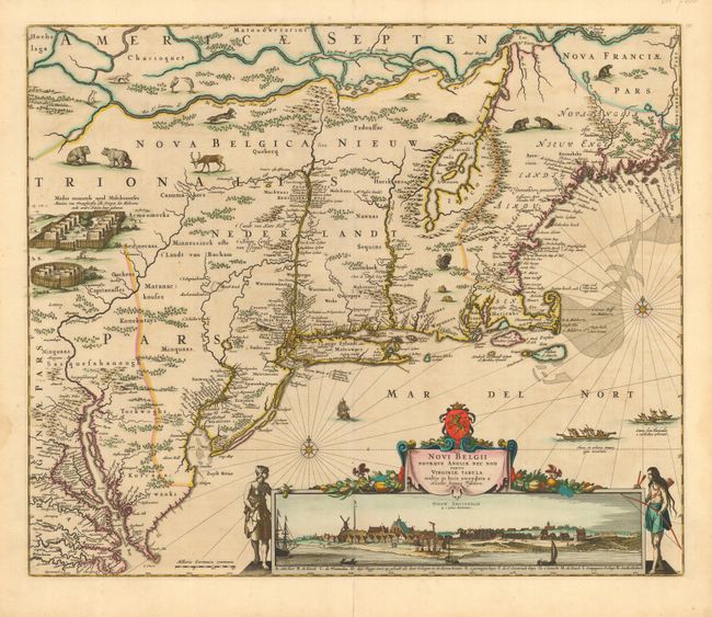
MapMaker: |
Nicolas Visscher
|
|
| |
| |
Subject: |
Colonial New England and Mid Atlantic |
|
| |
Period/Size: |
1656 / 18.3" x 21.8" (46.5 x 55.4 cm)
|
|
| |
Color: |
Colored
|
|
| |
Condition: |
(A+) Fine impression and original color. Faint damp stains in blank margins, still a very fine example of this important map. (condition help) |
|
| |
Source: |
|
|
| |
References: |
Augustyn & Cohen pp. 32-33; Burden #315; McCorkle #655.1; Stokes pp. 147; Tooley (Amer) p. 285, #5. |
|
| |
|
|
| Sales Information |
| |
| |
Price: |
|
|
| |
| |
Offered by: |
Old World Auctions |
|
| |
Catalog: |
Auction No. 113 - Antique Maps, Charts, Atlases & Globes (566) |
|
| |
Lot/Item #: |
174 |
|
| |
| |
Date: |
12/2005
|
|
| |
| |
|