Title:
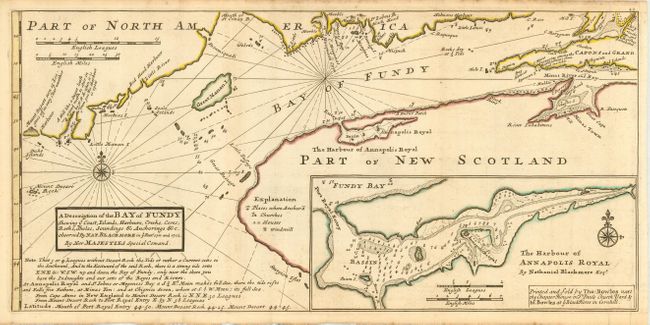
“A Description of the Bay of Fundy Showing ye Coast, Islands, Harbours, Creeks, Coves, Rocks, Sholes, Soundings & Anchorings &c.”
Map Maker:
Herman Moll
Fascinating map covering part of the coast of Main... (full text available to subscribers)
| Item Detail |
| |
| |
MapMaker: |
Herman Moll
|
|
| |
| |
Subject: |
Canada and Maine |
|
| |
Period/Size: |
1745 / 8.2" x 17.0" (20.9 x 43.2 cm)
|
|
| |
Color: |
Colored
|
|
| |
Condition: |
(A) Very nice impression on a sheet of hand laid paper with original margins and large fleur-de-lys watermark. A hint of toning, mostly along fold, still very good. (condition help) |
|
| |
Source: |
Atlas Minor |
|
| |
References: |
Kershaw #763; Phillips (A) 574-54. |
|
| |
|
|
| Sales Information |
| |
| |
Price: |
|
|
| |
| |
Offered by: |
Old World Auctions |
|
| |
Catalog: |
Auction No. 114 - Antique Maps, Charts, Atlases & Globes (567) |
|
| |
Lot/Item #: |
118 |
|
| |
| |
Date: |
03/2006
|
|
| |
| |
|
Antique Maps - Valuation and Pricing, Descriptions, Resources |
|
Home |
Information |
Search |
Register |
Contact Us |
Site Map
Americana Exchange, Inc. © 1999 - 2024 Americana Exchange, Inc.. All rights reserved.
OldMaps.com, the OldMaps.com logo and
AMPR are service marks or registered service marks of Americana Exchange, Inc..
|