Title:
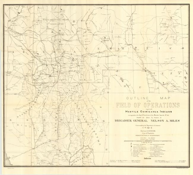
“Outline Map of the Field of Operations Against Hostile Chiricahua Indians Showing Operations from April 12th, 1886 to the Date of Their Surrender September 4th, 1886”
Map Maker:
U.S. War Department
Compiled and Drawn by direction of Brigadier Gener... (full text available to subscribers)
| Item Detail |
| |
| |
MapMaker: |
U.S. War Department
|
|
| |
| |
Subject: |
Southwest United States & Mexico |
|
| |
Period/Size: |
1886 / 25.3" x 29.0" (64.3 x 73.7 cm)
|
|
| |
Color: |
Black & White
|
|
| |
Condition: |
(A) Folding, as issued. Near mint example. (condition help) |
|
| |
Source: |
HR Ex 1 pt2 v1, 49th Cong., 2nd Sess. |
|
| |
References: |
|
|
| |
|
|
| Sales Information |
| |
| |
Price: |
|
|
| |
| |
Offered by: |
Old World Auctions |
|
| |
Catalog: |
Auction No. 114 - Antique Maps, Charts, Atlases & Globes (567) |
|
| |
Lot/Item #: |
294 |
|
| |
| |
Date: |
03/2006
|
|
| |
| |
|
Antique Maps - Valuation and Pricing, Descriptions, Resources |
|
Home |
Information |
Search |
Register |
Contact Us |
Site Map
Americana Exchange, Inc. © 1999 - 2024 Americana Exchange, Inc.. All rights reserved.
OldMaps.com, the OldMaps.com logo and
AMPR are service marks or registered service marks of Americana Exchange, Inc..
|