Title:
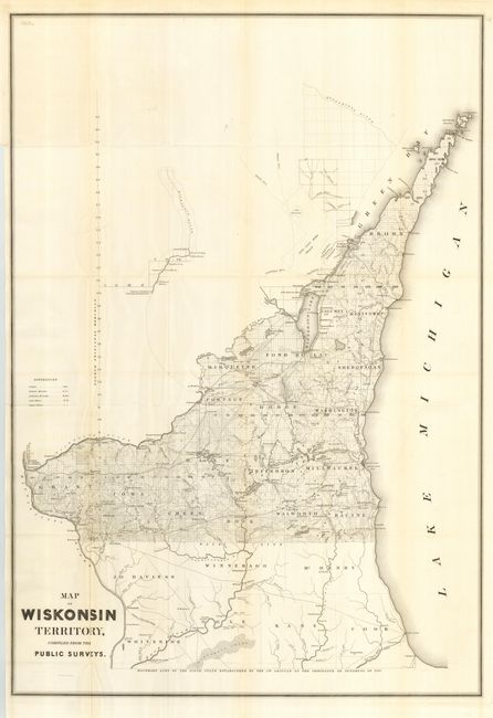
“Map of Wiskonsin Territory, compiled from the Public Surveys”
Map Maker:
U.S. Government
This is a great, early map of Wisconsin showing th... (full text available to subscribers)
| Item Detail |
| |
| |
MapMaker: |
U.S. Government
|
|
| |
| |
Subject: |
Wisconsin |
|
| |
Period/Size: |
1839 / 35.0" x 24.0" (88.9 x 61.0 cm)
|
|
| |
Color: |
Black & White
|
|
| |
Condition: |
(A) Folding, as issued. Trace of toning along some folds. (condition help) |
|
| |
Source: |
Sen Doc 140, 26th Congress 1st Session |
|
| |
References: |
Claussen & Friis #329. |
|
| |
|
|
| Sales Information |
| |
| |
Price: |
|
|
| |
| |
Offered by: |
Old World Auctions |
|
| |
Catalog: |
Auction No. 114 - Antique Maps, Charts, Atlases & Globes (567) |
|
| |
Lot/Item #: |
286 |
|
| |
| |
Date: |
03/2006
|
|
| |
| |
|
Antique Maps - Valuation and Pricing, Descriptions, Resources |
|
Home |
Information |
Search |
Register |
Contact Us |
Site Map
Americana Exchange, Inc. © 1999 - 2024 Americana Exchange, Inc.. All rights reserved.
OldMaps.com, the OldMaps.com logo and
AMPR are service marks or registered service marks of Americana Exchange, Inc..
|