| Item Detail |
| |
| |
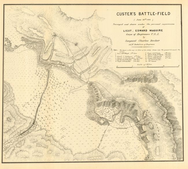
MapMaker: |
Edward Maguire
|
|
| |
| |
Subject: |
Montana |
|
| |
Period/Size: |
1876 / 15.0" x 17.5" (38.1 x 44.5 cm)
|
|
| |
Color: |
Black & White
|
|
| |
Condition: |
(B) Folding, as issued. Two long tears, nearly invisibly closed on verso, else very good to fine. (condition help) |
|
| |
Source: |
Annual Report of Lieutenant Edward Maguire, Corps of Engineers… |
|
| |
References: |
Wheat (TMW) #1266. |
|
| |
|
|
| Sales Information |
| |
| |
Price: |
|
|
| |
| |
Offered by: |
Old World Auctions |
|
| |
Catalog: |
Auction No. 114 - Antique Maps, Charts, Atlases & Globes (567) |
|
| |
Lot/Item #: |
247 |
|
| |
| |
Date: |
03/2006
|
|
| |
| |
|