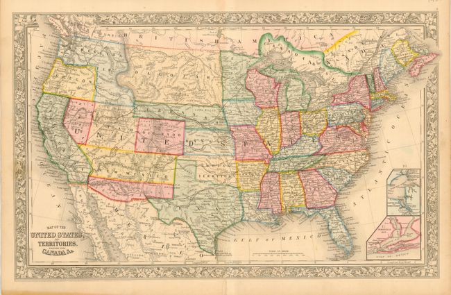
Title:
“Map of the United States, and Territories. Together with Canada &c.”
Map Maker:
Samuel Augustus Mitchell
A terrific map published at a time when many terri... (full text available to subscribers)
| Item Detail |
| |
| |
MapMaker: |
Samuel Augustus Mitchell
|
|
| |
| |
Subject: |
United States |
|
| |
Period/Size: |
1860 / 13.3" x 21.0" (33.8 x 53.4 cm)
|
|
| |
Color: |
Colored
|
|
| |
Condition: |
(A) Very fine impression and coloring with full margins. Some marginal toning at bottom left well away from map. Short split at centerfold in lower margin just touching neatline, one lazy fold along centerfold. (condition help) |
|
| |
Source: |
New General Atlas |
|
| |
References: |
|
|
| |
|
|
| Sales Information |
| |
| |
Price: |
|
|
| |
| |
Offered by: |
Old World Auctions |
|
| |
Catalog: |
Auction No. 114 - Antique Maps, Charts, Atlases & Globes (567) |
|
| |
Lot/Item #: |
136 |
|
| |
| |
Date: |
03/2006
|
|
| |
| |
|
Antique Maps - Valuation and Pricing, Descriptions, Resources |
|
Home |
Information |
Search |
Register |
Contact Us |
Site Map
Americana Exchange, Inc. © 1999 - 2024 Americana Exchange, Inc.. All rights reserved.
OldMaps.com, the OldMaps.com logo and
AMPR are service marks or registered service marks of Americana Exchange, Inc..
|