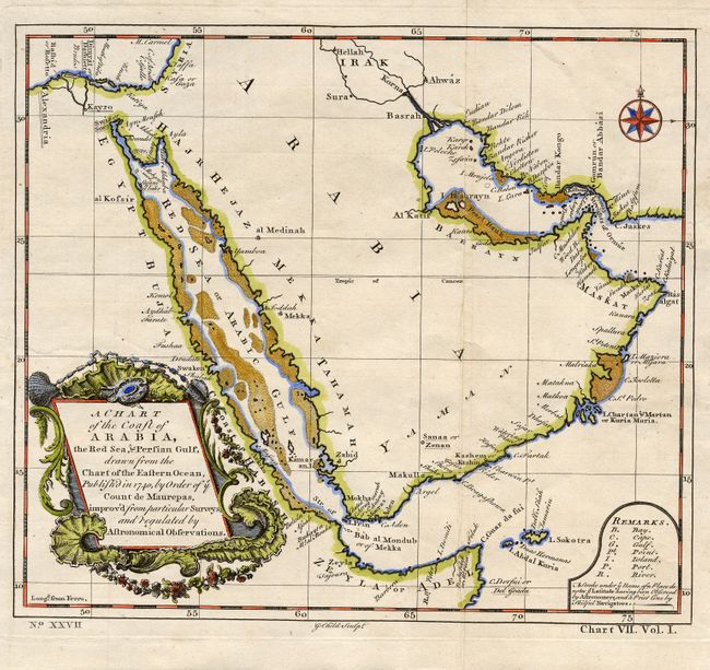
Title:
“A Chart of the Coast of Arabia, the Red Sea, & Persian Gulf, drawn from the Chart of the Eastern Ocean…”
Map Maker:
G. Child
Centered on Arabia, the map extends to show the ci... (full text available to subscribers)
| Item Detail |
| |
| |
MapMaker: |
G. Child
|
|
| |
| |
Subject: |
Arabia |
|
| |
Period/Size: |
1740 / 8.6" x 9.8" (21.9 x 24.9 cm)
|
|
| |
Color: |
Colored
|
|
| |
Condition: |
(A) Beautiful, early impression on hand laid paper with original margins. Small marginal stain at right. Modern coloring with a little show-though on verso. (condition help) |
|
| |
Source: |
Universal Traveller |
|
| |
References: |
|
|
| |
|
|
| Sales Information |
| |
| |
Price: |
|
|
| |
| |
Offered by: |
Old World Auctions |
|
| |
Catalog: |
Auction No. 114 - Antique Maps, Charts, Atlases & Globes (567) |
|
| |
Lot/Item #: |
580 |
|
| |
| |
Date: |
03/2006
|
|
| |
| |
|
Antique Maps - Valuation and Pricing, Descriptions, Resources |
|
Home |
Information |
Search |
Register |
Contact Us |
Site Map
Americana Exchange, Inc. © 1999 - 2024 Americana Exchange, Inc.. All rights reserved.
OldMaps.com, the OldMaps.com logo and
AMPR are service marks or registered service marks of Americana Exchange, Inc..
|