| Item Detail |
| |
| |
MapMaker: |
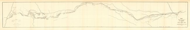
U.S. War Department
|
|
| |
| |
Subject: |
Southwestern United States |
|
| |
Period/Size: |
1858-9 / 7.0" x 48.5" (17.8 x 123.2 cm)
|
|
| |
Color: |
Black & White
|
|
| |
Condition: |
(A) Folding as issued. A near fine example of this map with only very light toning in upper margin. (condition help) |
|
| |
Source: |
HR Doc 42, 36th Cong. 1st Sess. |
|
| |
References: |
Wheat [TMW] #939; Koepp #1048. |
|
| |
|
|
| Sales Information |
| |
| |
Price: |
|
|
| |
| |
Offered by: |
Old World Auctions |
|
| |
Catalog: |
Auction No. 114 - Antique Maps, Charts, Atlases & Globes (567) |
|
| |
Lot/Item #: |
196 |
|
| |
| |
Date: |
03/2006
|
|
| |
| |
|