Rister or Sign In to see pricing information


Title:

Carte de la Cote N.O. de l' Amerique et de la Cote N.E. de l' Asie, Reconnues en 1778 et 1779…

Map Maker:

Cook/Benard

Carte de la Cote N.O. de l' Amerique et de la Cote N.E. de l' Asie, Reconnues en 1778 et 1779…

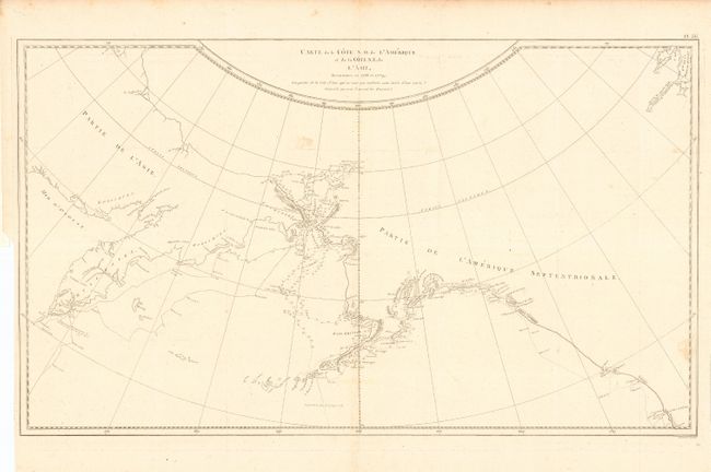
This chart details Cook's 1778 explorations and th... (full text available to subscribers)
Item Detail
 
  MapMaker:  

Cook/Benard


  Subject:  North Pacific Ocean  
  Period/Size:  1785 / 15.2" x 26.0"  (38.6 x 66.1 cm)  
  Color:  Black & White  
  Condition:  (A) Folding, as issued. Delicate impression on thick hand laid paper with original margins. One light foxing mark in blank area above the Bering Strait. (condition help)  
  Source:   
  References:   
 
 
Sales Information
 
  Price: 

Please register your email to view records, or sign in with email address to see records


  Offered by:  Old World Auctions  
  Catalog:  Auction No. 114 - Antique Maps, Charts, Atlases & Globes (567)  
  Lot/Item #:  671  
 
  Date:  03/2006  


Antique Maps - Valuation and Pricing, Descriptions, Resources


Home | Information | Search | Register | Contact Us | Site Map

Americana Exchange, Inc. © 1999 - 2024 Americana Exchange, Inc.. All rights reserved. OldMaps.com, the OldMaps.com logo and
AMPR are service marks or registered service marks of Americana Exchange, Inc..